Tuesday, December 30, 2014

New Boise and other Idaho Cities Google Earth 3D imagery has just become available.

For the past few years Google Earth has been adding a new kind of 3D imagery in cities around the world. I looked at the recent update on the Google Earth Blog and found Boise and other cities in the Treasure Valley has just been added.
Other cities in Idaho that contain the new 3D imagery are Pocatello, Idaho Falls, Lewiston and Coeur d'Alene.

 I am adding one screen shot here that shows the area outlined in red where you can see the new imagery in the Treasure Valley, including the Boise River near Boise, Meridian, Nampa and Caldwell when you turn on the 3-D buildings in the Google Earth Browser.


Below  I I will also add a screen shot showing the new imagery near Barber Park and the Boise River.


Sunday, December 21, 2014

2017 Total Solar Eclipse Path Across Idaho

I just read another article with good photos and information about the Total Solar "Eclipse of a Lifetime" on August 21, 2017. "Start planning for it now!" I will add two screen shot photos here identifying the eclipse path for my friends who live in, or will visit, Idaho during the eclipse.

https://medium.com/starts-with-a-bang/weekend-diversion-the-eclipse-of-a-lifetime-is-coming-bf32df48ac62

For friends who live in or visit Idaho, below are 2 static maps showing the path and some of the towns the total solar eclipse will cross in Idaho on Monday August 21, 2017.  It will be interesting to see what these communities do to celebrate this celestial phenomena.  Please comment if you have ideas for these celebrations.


Credit for the Eclipse path that covers the entire U.S.
http://xjubier.free.fr/en/site_pages/SolarEclipsesGoogleEarth.html


Saturday, November 08, 2014

Natural Wilderness VS Management / Stewardship?

"The Wilderness Paradox" an article by Jordan Fisher Smith in Orion Magazine provides an important perspective wilderness advocates might consider.   
        
http://www.orionmagazine.org/index.php/articles/article/8273

The article quotes Roderick Nash in his 1978 text book "Wilderness Management."
"A designated, managed wilderness is, in a very important sense, a contradiction in terms. It could even be said that any area that is proclaimed wilderness and managed as such is not wilderness by these very acts! The problem is that the traditional meaning of wilderness is an environment that man does not influence, a place he does not control."
My 1971 Photo on West Buttress of Denali  published in "The Smithsonian Magazine" article about clean up efforts on the mountain.

The 1964 Wilderness Act was a significant event in American culture and has been celebrated by wilderness advocates now for 50 years.  However the act itself included a number of well documented political and economic compromises that   were necessary for contemporary congressional representatives to seriously consider passing it.  These compromises by themselves severely limited what the concept of wilderness could have been. By 1964 one hundred short years of grandfathered livestock grazing, mining, guided hunting, floating, back county airports and other uses were built into the act. And recently we have seen accepted helicopter spraying for weeds, wolf control and other federal and state management actions that I believe most wilderness advocates would not believe to have been possible some years ago.

Even the fixed boundaries where some popular access roads started to cause overcrowding resulting in the perceived need for wilderness permit requirements, and law enforcement by managers.  If the wilderness boundaries had been made flexible and popular access roads closed, requiring wilderness users to walk more distance these management tools would not be as necessary.  Even the act of maintaining trails for easy access for horses and hikers eliminates some of the naturalness of a wilderness, not to mention the maintenance of existing wilderness airfields and buildings.

Two examples of wild areas that have become overcrowded because of easy access that could be moved back include the Middle Fork of the Salmon River in Idaho and the West Buttress Route on Denali.  At one of the Wilderness Conferences it was revealed that the existing road into Dagger Falls was originally supposed to be only temporary in the 1931 designated primitive area that then existed.  Punched in with the notion that mankind could engineer a way to "help" salmon get up Dagger Falls more easily than they had for milenia, the primitive area rules required that this road would not be permanent. However, as we now know thousands of trucks, vans,and  busses carry boats, gears and guided customers of private companies and self organized public groups to the well constructed put in point just below Dagger Falls.  If this road did not exist, floating the Middle Fork would require at least on more day and would also require a portage of Dagger Falls that most guides and paying customers never like to do.  On Denali, the most popular West Buttress route requires permits because the Park Service allows bush pilots to ferry people into a close approach on the Kahiltna Glacier.  Just eliminating the airplane access and helicopter rescues would require a much larger effort and commitment to climb this highest wild peak in North America.  In 1975 I was involved in a 60 day "Clean Climbing" Expedition that attempted to demonstrate this concept.

Personally, I have been an active participant in Wilderness issues and activities during this 50 year period, in Idaho, Oregon and Alaska and other western areas.  In my youth I hiked and hunted in the primitive areas that later became the Selway Bitterroot and Frank Church Wilderness Areas in Idaho.   In the late 1960's at the University of Oregon Outdoor Program we initiated actions help to Save the French Pete Wilderness.  I helped organize a several year effort to manage trash and access Mt. McKinley (Denali) in Alaska and on the Lower Salmon River in Idaho.  We organized "Wilderness Use Ethics" and "Wilderness and Individual Freedom" conferences and also published "Free Country Times" and "Cooperative Wilderness Adventures" for several years at the University of Oregon. I have also hiked, backpacked, photographed and produced many multimedia programs and web site projects that have wilderness and natural environment themes over the past 35 years with Katy Flanagan and Mountain Visions.


Wednesday, November 05, 2014

Unique online conference with live streaming and collaborative dialogue opportunities.

Nov. 5-7, 2014 A unique online conference and separate collaborative dialogue project for the "The Next Stepp: Sage Grouse and Rangeland Wildfire in the Great Basin" conference being held in Boise, Idaho.

http://www.nifc.gov/fireandsagegrouse/index.html


I am now watching the "live stream" at the conference

http://new.livestream.com/accounts/10631879/sagegrouseandfire


A few days ago I logged in and provided some online ideas and comments on the Mindmixer dialogue for this conference.  You can also sign up and add your own.

http://nextsteppe.mindmixer.com/topics/all


Monday, October 27, 2014

Polarized Americans and what we can do in our neighborhoods, cities and towns.

I read this recent depressing article by Don Hazen, editor of AlterNet for 20 years but was inspired by comments he made at the end of the piece.

On page 7 he notes he was struck by the statistics showing steady polarization going on in our country today that seems to be paralyzing our government.

We..."are not prepared for a future where politics is even more dicey and dangerous than it is now. So we have to stop going through the motions of not producing change and get down to the basics where and when we can make a difference." 
"Let's do more political action with friends and colleagues. Let's agree that a higher level of popular political education and self-reflection is necessary. Let's build up ways in our neighborhoods, cities and towns, where progress can be made...."

In Boise, Idaho organizations, neighborhoods and the city provide opportunities for discussions of this type that we can participate in.  Below are just a few examples:
Vistaboise Nextdoor Network
Vista Neighborhood Association Public Facebook Group
City of Boise Energize our Neighborhoods
Boise River Enhancement Network


Monday, October 06, 2014

Kimi, Our Alaskan Malamute, wears a GoPro Camera

We were canoeing on a lake near Yellowstone National Park and put a GoPro camera on one of the dogs, Kimi our Alaskan Malamute. The dogs ran through the brush and swam out to the canoe a few times. A second GoPro camera was used to shoot some underwater shots of the dog swimming.  We also used an iPhone to capture the dogs swimming alongside the canoe.

This first video has been edited with several cuts pieced together and a background music track added.  It is about 3 minutes 23 seconds in length.  Posted to YouTube.


This second video is about 8 minutes and 45 seconds long and has not been edited.  It shows Kimi's movements with the GoPro camera connected to a a Fetch harness running through the brush , swimming out to the canoe and greeting us back at the takeout point at the end.  The GoPro is enclosed in a waterproof case and the sound is generally muffled.  But the sounds of the brush and rain hitting the camera and Kimi whining when she sees the canoe are interesting.    Posted to YouTube.


Tuesday, September 09, 2014

Weiser River Galloway Dam Proposal in Idaho

 We (Mountain Visions) helped Idaho Rivers United produce this Video about "The Weiser River - Idaho's Free-Flowing Gem.  A Google Earth flyover shows the river and the area that would be inundated by the dam.  Some nice photos are included of the Weiser River and trail and wildlife.

 See also this IRU News page about the proposed dam and a meeting in Weiser, Idaho on September 11, 2014.


Friday, September 05, 2014

Wilderness And Individual Freedom Conference Proceedings, 1976, University of Oregon Outdoor Program

I participated in and have a copy of the proceedings for this unique national Wilderness conference sponsored by the University of Oregon Outdoor Program, Oregon Committee for the Humanities, and   A.S.U.O. Survival Center and Cultural Forum.

The Conference "to examine the public wilderness resource and its implications for the American citizen's future" was held at Mt. Hood, Oregon on March 4-6, 1976.

David Brower, Willi Unsoeld, Edward Abby, Roderick Nash, John Miles , Rick Applegate, Brock Evans, Roger Mellum, Dee Molenar, Roger Robinson and 143 others participated in this national conference organized by active wilderness users participating in the University of Oregon Common Adventure Outdoor Program. Todd True and Katy Flanagan were the conference organizers. 

The 116 page document is apparently available at the University of Oregon.


The following is a quote about the conference found on ERIC Institute of Education Sciences. (I separated the main topic sentences and bolded one section for emphasis.)

"A fundamental statement of the only philosophy that can really lead to protection of wild lands emerged from the proceedings of the March, 1976 Wilderness and Individual Freedom Conference--

there must be more citizen participation in wilderness decisions because there is a great diversity of wilderness users and because we cannot separate what happens in the wilderness from what happens in our lives. 

Some 113 (sic) participants attended the three day conference that featured keynote speakers, panel discussions, small group seminar discussions, and slide presentations. Proceedings of all these events are included in this document. 

The script of the multi-media slide presentation on wilderness and individual freedom is given.

 Personal, management and broad perspectives on the historical and philosophical foundations of the American wilderness dream are summarized from a panel discussion on that subject. 

One keynote address deals with the rights and freedoms that must be protected for the individual citizen's use of wilderness resources and a subsequent seminar discussion lays the foundation for a charter of essential wilderness freedoms.

 Other panel discussions and discussion groups work with the problem of individual freedom and wilderness preservation. 

Proceedings on the final conference day were directed toward the major conference question of "How can we maximize freedom and minimize impact in the wilderness resource?" (DS)"


The "Wilderness" Project Faire included 29 displays and sign up sheets developed by individuals and organizations inviting conference participants to become involved in planning and actualizing public Wilderness projects

Wilderness Use Ethics Conference Proceedings, 1974 - University of Oregon Outdoor Program

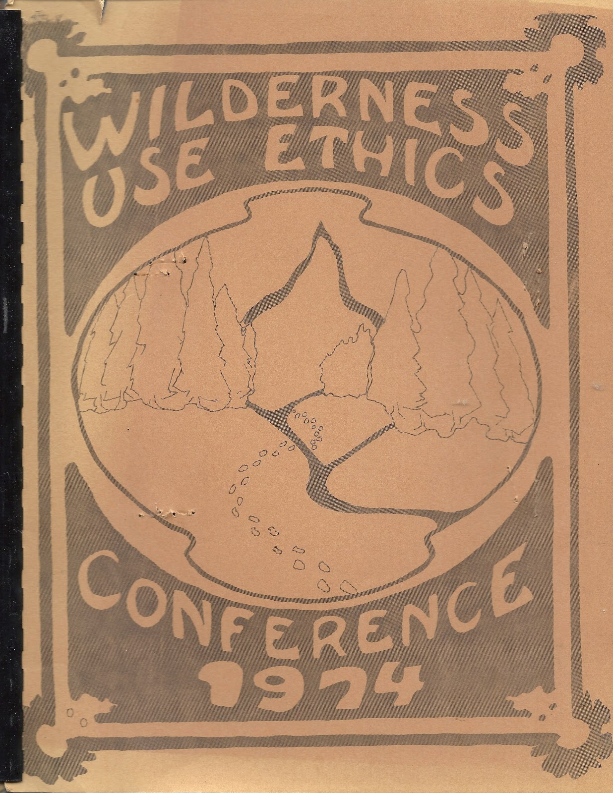
I participated in and have a copy of the proceedings of this conference, but until fairly recently I could not find a reference doing a search on the Internet.  Now there are a few search results you can find for it on Google for "Wilderness Use Ethics Conference"  The 74 page document is apparently available at the University of Oregon.


This unique conference was organized by users of wilderness concerned that the vast majority of wilderness environmental energy had been going towards land classification efforts. The problem of wilderness user impact, overcrowding, human waste disposal, noise pollution and other impacts, even in sparsely used areas was on the rise and needed to be addressed.  The conference was organized by the University of Oregon Outdoor Program.  Bruce V. Mason, Conference Coordinator.
The Wilderness Use Ethics Conference held on April 25-28 at Mckenzie Bridge, Oregon brought together a knowledgeable and diverse group of wilderness users, managers and research personnel to discuss these issues and to encourage a management ethic that allows increased public input into wilderness and wild river management plans.
Conference participants developed nine unique model environmental wilderness projects in Idaho, Oregon and Washington that were implemented after the conference. One of these was the Lower Salmon River Cleanup in Idaho that involved over 100 people, took 3 years and received the 1976 National Environmental Award, the highest public service award that can be presented by the U.S. Department of Interior.

Project reports included in the proceedings included the following:
  1. Willamette River Cleanup  - Mel Jackson, City of Eugene, Oregon
  2. Alpine Lakes Wilderness Cleanup in Washington - Mike Collins, Recreational Equipment, Inc.,  Seattle Washington
  3. Three Public Education Projects in Washington - John Miles, Western Washington State
  4. Human Waste Disposal Survey - Mike Saul, Sundance Expeditions, Grants Pass, Oregon
  5. An Environmental Practices Book - Robert R. Bostick, Oregon State University
  6. Public Wild River Environmental Project - Gary O. Grimm, University of Oregon
  7. Owyhee River Study Project - Kathleen Howes, University of Oregon
  8. Middle Fork Salmon River Environmental Project - Gary O. Grimm, University of Oregon
  9. Salmon River Cleanup - Art Pope, University of Oregon


Wednesday, September 03, 2014

French Pete Wilderness Protest November 18, 1969

After the Wilderness Act was passed in 1964 many people were visiting these unique areas and also surrounding areas that had not been included in the act.  French Pete was one valley that was not included in the Three Sisters Wilderness area and was found to be scheduled for clear cut logging in the near future.

With friends in Eugene I hiked and skied in this area in the late 1960s and, was involved with in what may have been the first public demonstration against national forest policy ever held. In Eugene, an estimated crowd of 1500, composed of students and faculty at the University of Oregon, community citizens and members of environmental groups marched to the headquarters of the Willamette National Forest. An Outdoor Program Common Adventure project called "Nature's Conspiracy" organized the rally.

Author Ken Kesey spoke briefly in support and entertainer Mason Williams gave a free concert later.

After the rally logging was temporarily delayed in the French Creek Valley while appeals were considered.

A Save French Pete Committee and other groups including the Friends of the Three Sisters Wilderness, the Oregon Conservation Council, the Eugene Natural History Society, and outdoor groups like the Obsidians and the Chemeketans kept fighting for Wilderness designation.

At the U.of O Outdoor program we also organized a public "Environmental Meetings" in 1971 and later to continue the dialogue about French Pete and similar Wilderness issues

 Nine Years later French Pete was added to the Three Sisters Wilderness system.

Do a Google Search for "Save French Pete Rally" to find news and historical articles.


Kevin R. Marsh in his book "Drawing lines in the forest: creating wilderness areas in the Pacific Northwest" provided this insight.

"The growing counterculture movement at the time lent support and participants to this this new era of wilderness protests.  Historian Roderick Nash noted in 1973,  'The environmental renaissance of the late1960s and early 1970s paralleled a deep-rooted questioning of established American values and institutions on the part of what some labeled the 'counterculture.' Wilderness and the idea of Wilderness played a key role in both social-intellectual movements.'  Protests in Eugene to preserve French Pete from logging gave that community a national reputation for environmental activism.  Bob Wazeka compared Eugene's role in the wilderness movement of the 1970s to the role of Paris as the center of the Western Literary World of the 1920s."

I also plan to post similar information about personal experiences I have had with the  1964 Wilderness Act issues as time permits.  The following are potential examples. 


  • Common Adventure Outdoor Program - University of Oregon 1967
  • Denali Clean Climbing and Cleanup 1970s
  • Wilderness Environmental Pursuits 1972
  • Cooperative Wilderness Adventures 1973-79
  • Wilderness Use Ethics Conference - 1974
  • Salmon River Cleanup - 1970s
  • Wilderness and Individual Freedom Conference 1976
  • Selway Bitteroot and River of No Return Wilderness Traverse 1979
  • Moonshadow - Total Eclipse of the Sun 1979
  • Canoe Expedition entire length of Salmon River in Idaho 1980
  • Owyhee Canyonlands video 1993
  • Visions of Wilderness video 1993
  • 360 degree interactive panoramas of Idaho Wilderness areas 2003- 2014
  • Google Earth and Map projects 2006-2016

Thursday, August 21, 2014

New Google Earth Imagery for SW Idaho

This Google Earth Blog today provided a kml file for fresh new Google Earth Imagery.

I noticed that a big section of SW Idaho including the Snake River starting at Grandview to Weiser, the Boise River to Lucky Peak Dam, the Payette River to Horseshoe Bend, and a small part of the Weiser River is included.


Monday, August 18, 2014

Lucky Peak Reservoir, Idaho Gigapan

I shot another Gigapan (190 telephoto images) looking over Lucky Peak Reservoir on the same day as Arrowrock Dam. (April 20, 2013)
http://www.gigapan.com/gigapans/161001
The small image below can be viewed full screen. The Gigapan page link above provides thumbnail snapshot views that will zoom in to some interesting features. Use the full screen option in both views to see the highest definition and quality. You can also view these Gigapans in Google Earth and on Google Maps.


Arrowrock Dam Boise River Idaho Gigapan

I uploaded this 260 telephoto stitched image of the Arrowrock Dam to my Gigapan site. You can zoom in on the photo to see fine details. Use the "full screen" option to see the highest quality.http://www.gigapan.com/gigapans/160997


There is study plan to raise the level of the dam 70 more feet to store more water above Boise. Do you agree that this needs to be done? Below is a link to an Idaho Rivers United opinion.

Saturday, August 16, 2014

Barry Lopez - French Pete Rally Protest in Eugene, Oregon on November 18, 1969

Read Barry Lopez article  in Outside Online titled "The Case for Going Uncivilized."  

I lived in the Eugene Area and knew Barry Lopez during the late 1960s and  1970s.  I was also involved with many other community members and students in the French Pete Rally Protest in Eugene, Oregon on November 18, 1969.


Barry describes this protest in the article and explains that "The Wilderness Act had stripped the Forest Service of the power it once had to designate wilderness areas, turning it over instead to Congress, where citizens had the right to actively participate in the process."

"The industry, of course, never got the timber in French Pete, but the fight against corporate greed, ethical compromise, special-interest land management, and excessive development hasn’t ended. We enlighten each other; we heal our wounds; and the young take to the walls yet again—with great courage, great effort, great faith. Then, for a few more years, we feel blessed."

I found this additional  interesting quote in a book titled "Drawing lines in the forest: creating wilderness areas in the Pacific Northwest" by Kevin R. Marsh about the French Pete protest.  "Protests in Eugene to preserve French Pete from logging gave that community a national reputation for environmental activism. Bob Wazeka compared Eugene's role in the wilderness movement of the 1970s to the role of Paris as the center of the Western literary world of the 1920s."
http://www.amazon.com/Drawing-Lines-Forest-Weyerhaeuser-Environmental/dp/0295990112

Friday, August 15, 2014

"Mother of All" Human Caused Atmospheric Water Vapor Feedback Amplifying Mechanism.

"Stick a Fork in it!" (See Dr. Andrew Dessler quote below.)

Is it way too late to control a "human caused water vapor feedback amplifying mechanism" that results in a wetter atmosphere and increasingly unprecedented storms on earth?


Future and general universal and temporal knowledge about overall climate change and global warming on Earth may be generally unpredictable given our current state of scientific knowledge, however many rigorous studies provide very strong evidence that human causes are at least partly responsible and therefore could be mitigated somewhat if public pressure and political will were aligned to this end.  We have had decades of forewarning about this problem and the human caused results are increasing without significant solutions being formulated by our political leaders.

This recent article hosted by the Guardian by John Abraham and Dana Nuccitelli titled "Global warming is moistening the atmosphere" provides details about a long term study that provides scientific evidence that "Human-caused global warming is causing the upper troposphere to become wetter."

One quote at the bottom of the article is attributed to Dr. Andrew Dessler;

Because of water vapor’s importance as a greenhouse gas, the water vapor feedback occupies a central role in the climate system. Over the years, our understanding of this process has increased steadily, and this paper is a very useful contribution. It nicely demonstrates that the observations of upper tropospheric moistening are unlikely to have arisen without the increase in carbon dioxide from human activities. At this point, I think it would be fair to say, “stick a fork in it, the water vapor feedback’s done.”

Another review of this article and interesting comments are available via this Daily Kos  post by Lefty Coaster titled. " Global Warming is increasing moisture in Earth's atmosphere driving Mother of all Feedback Loops"


Wednesday, June 04, 2014

Participatory Totalitarianism Article

Insightful article by John Feffer by Foreign Policy in Focus - June 4, 2014

Participatory Totalitarianism | Common Dreams

http://www.commondreams.org/view/2014/06/04-10

"We are not passive objects of the surveillance state. We are active subjects of our own YouTube channels."


Saturday, May 03, 2014

My PicasaWeb / Google+ Photo Albums

Recently I have been able to photograph a few interesting bird photo sequences near Boise, Idaho.  Albums of these photos have been uploaded to my Facebook, Flickr and PicasaWeb (now also Google +) albums.

 I decided to make  a link to my Google + albums on this blog for those interested to view.

Below is a link and a screen shot of the albums containing Great Blue Herons, Great Horned Owls, Goose & Goslings, and Swainsons Hawks Mating from Google +.

                                    Gary O. Grimm Photo Albums on Google +


Boise River Management Plan Google Earth Map

Working with City of Boise Parks and Recreation Staff who provided a GIS map, Mountain Visions has produced the following Interactive Google Earth map. A link to this map is now active on the Parks and Recreation Online Open House section for the 2014 Boise River Management Plan.

Boise River Management Plan Google Earth Map


Saturday, April 19, 2014

Celebration Park - Snake River, Idaho - 360 interactive panoramas on a Google Map.

Recently I visited Celebration Park on the Snake River in Southwest Idaho.  This area is a developed park where educational programs are held to learn about the many Native American petroglyphs that exist in the area. Nearby there is also a historic railroad bridge that spans the river.

I walked around the area and shot several 360 degree panorama views.  Katy Flanagan and I (Mountain Visions) produced the high definition photos into interactive panoramas that you can view full screen and posted them on the Google Map below.


View Celebration Park Panoramas in a larger map

Saturday, April 12, 2014

Boise River Enhancement Network - Sharing Information Via an Online Community

In June 2012, we (Mountain Visions) started a unique online community networking project for the Boise River Enhancement Network (BREN)  Currently we are maintaining and updating the site as community members are collaborating on a two year effort to create a comprehensive enhancement plan for the long range future.
People interested in sharing, discussing and organizing enhancement concepts events and projects are encouraged to join this BREN “On Line / All the Time” communication effort.

Recently on the BREN site we have also initiated the experimental collaborative mapping project below in an attempt to start the creation of a comprehensive and interactive Google Earth/Map of the boise River Watershed.  This map provides a way for BREN members to identify map place marks that provide transparent web based information links to information resources and example restoration and enhancement projects that have happened in the past, that are currently in progress and those that are, or might be, planned for the future. 


View Boise River Enhancement Network Map in a larger map

Friday, March 28, 2014

On the Boise River, I have been shooting 360 degree panoramas with the iPhone. This is an example of one that I have produced into a video that moves from left to right and zooms in and out that also includes a sound track and text overlay.

Monday, February 17, 2014

Esri Enables Federal Agencies to Open GIS Mapping Data to the Public

This article by Alexander Howard on February 10, 2014 at readwrite.com provides details on how government agencies will be able to make more geospatial data available to developers and the public.

"The mapping software giant will take an unprecedented step, enabling thousands of government customers around the U.S. to make their data on the ArcGIS platform open to the public with a click of a mouse."
"Government agencies can use the new feature to turn geospatial information systems data in Esri's format into migratable, discoverable, and accessible open formats, including CSVs, KML and GeoJSON. Esri will demonstrate the ArcGIS feature in ArcGIS at the Federal Users Conference in Washington, D.C. According to Turner, the new feature will go live in March 2014."
Notice that the KML format used by Google Earth and Maps is mentioned.  It will be interesting to experiment with this new open source data availability as it becomes available for the Boise River Watershed.