On June 5, 2013 I wrote a related blog post about the Landsat 8 Satellite that provides additional acquisition of high quality observations of land use and land change.
As citizens we have to demand that our family, friends, neighbors, organizations, businesses and elected representatives learn how to pay attention to accumulated science and stand up and act in order to immediately and dramatically slow down the extreme human caused climate and ecosystem changes that have been geometrically increasing for decades.
The latest of the five Earth observing NASA satellite observatories, SMAP, (Soil Moisture Active Passive) was scheduled to be launched this weekend, January 31, 2015.

This observatory will produce the highest-resolution maps of soil moisture ever obtained from space. "The accuracy, resolution, and global coverage of SMAP soil moisture and freeze/thaw measurements are invaluable across many science and applications disciplines including hydrology, climate, carbon cycle, and the meteorological, environmental and ecology applications communities."
http://www.nasa.gov/smap/overview/
The GPM (Global Precipitation Measurement) observatory was launched on "February 27, 2014, carrying advanced instruments that will set a new standard for precipitation measurements from space."

"The data they provide will be used to unify precipitation measurements made by an international network of partner satellites to quantify when, where, and how much it rains or snows around the world. The GPM mission will help advance our understanding of Earth's water and energy cycles, improve the forecasting of extreme events that cause natural disasters, and extend current capabilities of using satellite precipitation information to directly benefit society."
CATS (Cloud-Aerosol Transport System) is a lidar remote-sensing instrument that will extend profile measurements of atmospheric aerosols and clouds from the International Space Station (ISS).

The CATS payload will improve our understanding of aerosol and cloud properties and interactions, as well as improve climate change models. CATS is specifically intended to demonstrate a low-cost, streamlined approach to developing ISS science payloads.
OCO-2 Orbiting Carbon Observatory was launched on July 2, 2014, and is NASA’s first dedicated Earth remote sensing satellite to study atmospheric carbon dioxide from Space.
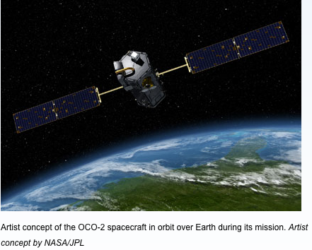
OCO-2 will be collecting space-based global measurements of atmospheric CO2 with the precision, resolution, and coverage needed to characterize sources and sinks on regional scales. OCO-2 will also be able to quantify CO2 variability over the seasonal cycles year after year.
ISS-RapidScat was launched on September 20, 2014 and is the first near-global scientific Earth-observing climate instrument specifically designed and developed to operate from the exterior of the space station.

The experimental mission will measure near-surface ocean wind speed and direction in Earth’s low and mid-latitudes in any kind of weather except heavy rain. The data will be used to support weather and marine forecasting, including tracking storms and hurricanes, and to study Earth’s climate.
No comments:
Post a Comment